 Directions


San Lourenzo Hillfort

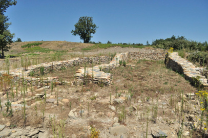
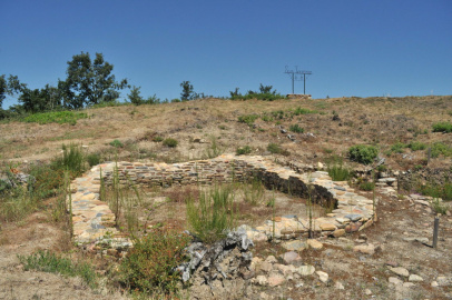
San Lourenzo Hillfort covers some 8,800 square metres. The site was originally a circular enclosure with a strong terraced wall. In some sections you can still see the rough stone blocks used for the outer facing of the wall, which had rounded quartzite corners.
The entrance to the hilltop was probably in the north-east, which is where the highest point of the hillfort can be found, and there was possibly a defensive tower next to the gate. One unusual feature is a kind of broken wall that runs from north to south and divides the hilltop into two parts. It was not a boundary fence as it had nothing to do with the area’s traditional system for parcelling out the land.
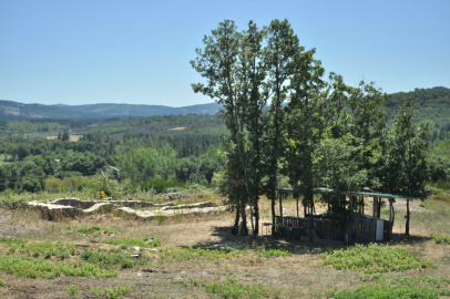
The Castro d’Alende or San Lourenzo is in the parish of San Pedro de Cereixa, on the right bank of the river Sáa on the small spine that forms the dividing line between the peneplain of A Chá de Castro and the river valley.
It was a fortified settlement built after the Roman Conquest to house the workers from the gold mines in the district in the 1st and 2nd centuries A.D. It was probably also linked with iron working, so that this would be a specialised village within the network of castros that controlled mining in the sedimentary basins of the rivers Lor, Sáa and Cabe.
In the Middle Ages the rural population of Cereixa built a hermitage dedicated to St. Lawrence, which was rebuilt in 1876 but later abandoned. At the end of the 1960s and beginning of the ‘70s, the south-west slope of the Castro was damaged by a gravel and sand pit. Currently, the area of the Castro is covered in native plants (especially oak trees) and scrub land.
The first enclosure was joined in the east to a second wall surrounding only a small area, nothing like the terraces that tend to form part of the fortified villages of the Iron Age. At the southern end, almost on top of the parapet is a mine entrance known as the Moors' Hole. This was a central feature for dating the site to Roman times.
On the hilltops in the north-west that were mined, it is normal to find extensions of ditches and walls so that significant water and mining resources could be kept on-site. These are called ‘brachia’ or arms, defensive lines that ensured a connection between the main fortified structure and other secondary and/or particular strategic points.
Castro de San Lourenzo
Information and contact


Castro de San Lourenzo - Cereixa
A Pobra do Brollón
Lugo

Equipment and Services

Accessibility

 What would you improve?