
PR-G 137 Ruta dos Soutos de Cesuris

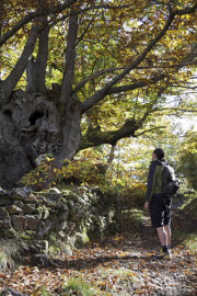
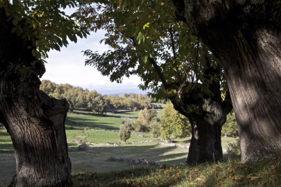
Among ancient chestnut trees, this route goes into the Central Massif to cover one of the most unknown areas within the municipality of Manzaneda. A place where, despite the ongoing depopulation, traditional activities such as animal grazing, farming and chestnut gathering are still kept alive.
 Directions
 After crossing San Miguel de Bidueira and leaving behind the parish church of the same name we come across the sign indicating the beginning of the route. From here, with the panoramic Prada Glacier behind us, we head towards the village of Trabazos, which hides the chapel of Santo Antonio, until we come to Cubeiros. From Borruga, crossing the Souto de Tonxil and Placín, we come to the end of the route on the outskirts of San Miguel de Bidueira. At this point it is possible to join PR-G 138 Ruta do Val Glaciar de Prada.


Don't miss!
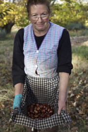
Durante los meses de octubre y noviembre los bosques de castaños o soutos se llenan de recolectores en busca de la castaña. La variedad más común en el municipio de Manzaneda es la castaña amarelante, de alta calidad y muy valorada en el mercado. Además de ser uno de los mayores productores nacionales de castaña, Manzaneda conserva el castaño de mayor perímetro de Galicia, ubicado en Rozabales y a poca distancia de la ruta.
El final de la temporada de la castaña está marcado por la actividad conocida como “A Rebusca”, en la que se seleccionan a mano las últimas castañas de la cosecha.
 What would you improve?