
A Cruz - Pena Pombeira Route

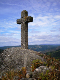
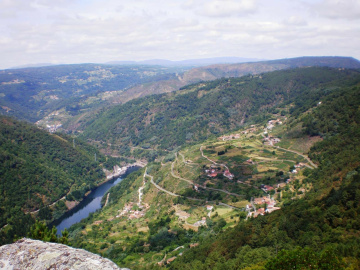
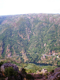
With this route you can visit two spectacular viewpoints over the Sil River. The first is named "A Cruz" (“The Cross”), which is derived from the large granite cross installed in the 1950s. The second is called "Pena Pombeira" (“Pombeira Rock”). At 707 metres in elevation, this is the highest point in the municipality of Pantón, and it offers magnificent vistas over the entire Lemos Valley and various locations in the provinces of Lugo and Ourense.
 Directions
 This route begins by walking along an unpaved road until reaching a junction with a sign indicating A Cruz. This is a spot of great beauty because of the views you can enjoy from here, over the course of the Sil River and the landscapes of Lugo and Ourense. Its name refers to a large stone cross, which was installed in memory of a "mission" that took place in the first half of the 20th century in the parish of Pombeiro.
Next you will walk back to the junction with the main path and continue along that route, walking upwards. After about 200 metres you will see a sign indicating the path to the Pena Pombeira Viewpoint. Located at an elevation of 707 metres, this is the highest point in the municipality. This viewpoint is an ideal location to observe the splendour of the Sil River, the Monastery of Santo Estevo towards the left, and the landscapes surrounding Nogueira de Ramuín, Chantada, Carballedo, and Monforte de Lemos. Further in the distance, O Courel, Castro Caldelas, and Manzaneda are also visible.
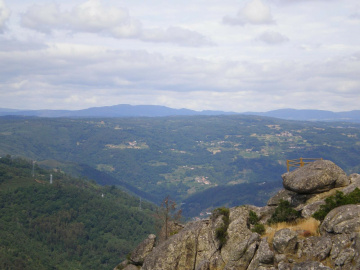
It is worth the effort to take a walk among the large stones. These are the remains of a glacial landscape, and they have taken on some unusual shapes over time.
Ruta A Cruz-Pena Pombeira
Equipment and Services


Accessibility


 What would you improve?