
PR-G 249 Old Aldosende Road

This is a linear route that is 11.3 kilometres long. It runs between Santiago de Aldosende and Santa Marta and the Cabo de Vila Viewpoint.
This route runs along a path that was installed in the 1960s, as a replacement for those between Santiago de Aldosende and the town of Portomarín that became submerged when the Belesar dam was built.
 Directions
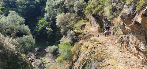
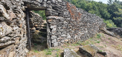
 The path begins in Aldosende, and after you pass through the village of Touro, it descends towards the valley of the Miño River. However, before reaching the shore of the Miño, the route runs along the Rego de la Trapa canyon. This section of the route was excavated directly into bedrock, with some very steep parts that can present a significant risk of falling. There are also various sections of stone stairways that were installed when the original path was constructed.
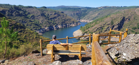
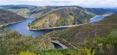
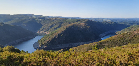
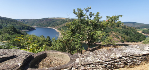
The route crosses the Trapa riverbed over a concrete bridge, and then it travels along the banks of the Miño River. This is an easy, flat section that offers excellent views over the river at all times.
This section ends at the San Facundo de Ribas de Miño complex, which consists of the parish church and its attached Rector’s House. This complex was declared as a Monument of National Interest, and it received the first award given by the Galician Institute of Architects for the best restoration project in Galicia.
The route continues along a cart path with walls on both sides, through vineyards and farms, until arriving in the location of A Adega dos Penedos. The ruins of several buildings can be seen in this area, along with some elements reflecting traditional rural life: stone washing basins, threshing floors, the remains of an agricultural trailer and a weaving loom, etc. There is also a promontory over the Miño River that provides some excellent views of the surrounding landscapes.
The final section runs through an oak grove until arriving at the village of Santa Marta, where you can visit the chapel and then continue on to the Cabo de Vila Viewpoint, which is the end of the route.
PR-249 CAMIÑO VELLO DE ALDOSENDE
Equipment and Services

 What would you improve?